Explore Old Maps of Ireland (From 15th to 21st Century)
Ordnance Survey Ireland has been responsible for gathering info and building the official map of Ireland used for government business since the office’s origination in 1824. Of course, cartography existed well before the 19th century, so there are hundreds of years of historic Irish maps prior, especially from the Tudor invasion of Ireland in the 1500s. Let’s explore the historic mapping of Ireland and explore history from a new vantage point!
Table of Contents
Old Maps of Ireland in 1500
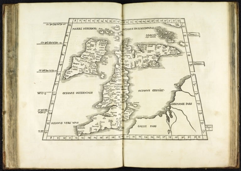
First off, this map was reproduced in 1525 but originally drawn by Cladius Ptolomy in Ancient Roman times. “Hiberniae” in Latin, Ireland came to Roman attention when they conquered Angliae (England). The Romans never actually succeeded in conquering Hiberniea so it is ironic that this map was reprinted just four years before the Tudors successfully invaded Ireland. The Tudor era began the “colonization” of traditional Gaelic Irish culture and marked the started of a strong historic paper trail.
This map was published nearly fifty years later, halfway through the Tudor Irish invasion. Part of Ireland has begun to be charted by English cartographers, as we can see in the thin rim of Irish cities showing on the left of this map of the British Isles.
Historic Maps of Ireland in 1600
The 1600s marked a stark change for Ireland, already invaded by the Tudors in the last century. This century brought British laws that stripped the native Irish, non-citizens, of their lands and reformatted them into either estates held by English aristocracy or plots granted to Scottish immigrants. The overall scheme was to weaken the locals’ hold and diminish rebellion. A few Irish were granted citizenship by denization, which meant their next generation reverted to non-citizenry.
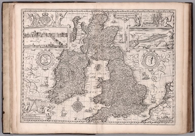
This map, from an atlas entitled “The Theatre of the Empire of Great Britian,” was originally produced in 1612 by John Speed, under the sponsorship of Queen Elizabeth I. The atlas made him one of the most well-known cartographers in British history. This version of the map was published in 1676, about fifty years after Speed’s death, when two of his atlases were re-printed together.
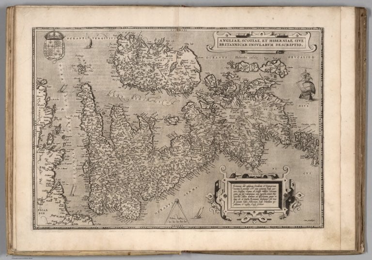
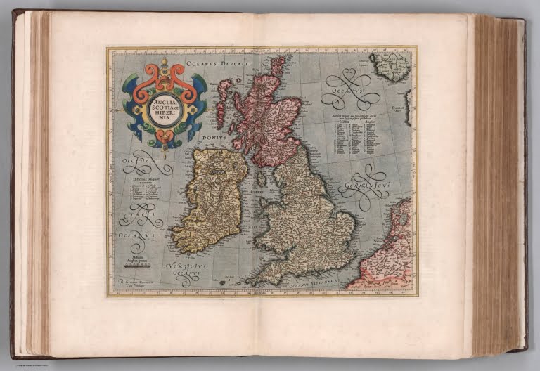
This map of Great Britain was actually a Dutch production, for an atlas published in Amsterdam. The Dutch were renowned during this era for their excellent maps, indeed this one is noted for its striking colors. The old Latin name was still used interchangeably at this time, leading to the map title “Anglia, Scotia, et Hibernia.”
Maps of Ireland in 1700
An early American immigration started this century when the wool trade out of Ireland was curtailed in favor of English merchants. This had been the primary market of Scottish-Irish workers in Ulster; impoverished and facing religious oppression, they set sail and settled primarily in Pennsylvania. With the Scots leaving, Ireland began experiencing a bit more class deafferentation – the gap grew between the 80% of the population that retained Irish Catholic beliefs versus the Protestant English. That didn’t really make a striking impact on the maps yet however.
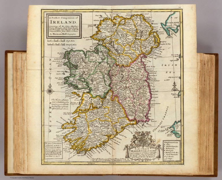
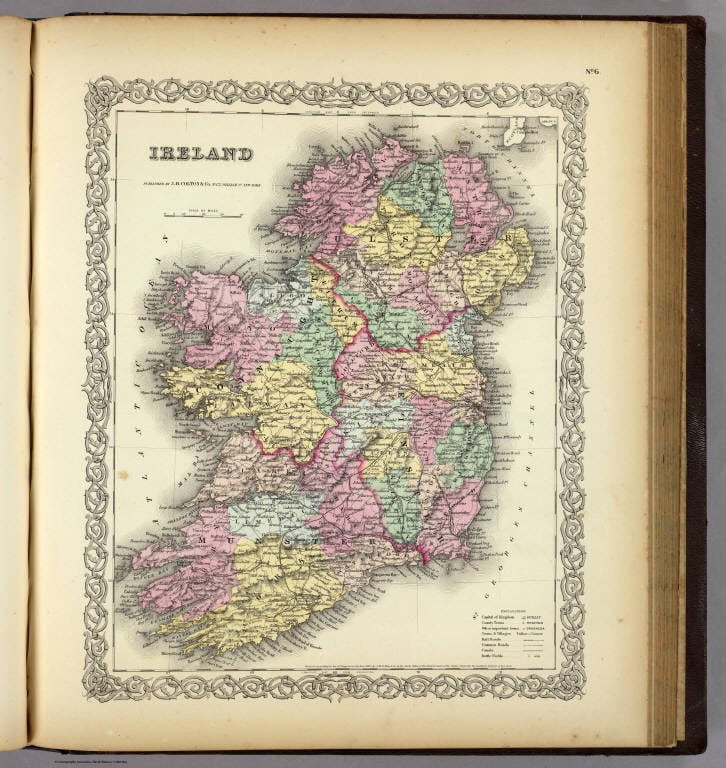
The first map does show the first instance we’ve seen in this list of the traditional Irish provinces being recorded: Ulster, Leinster, Munster, & Connaught. Note Ulster’s southern boundary line, it comes into play again later.
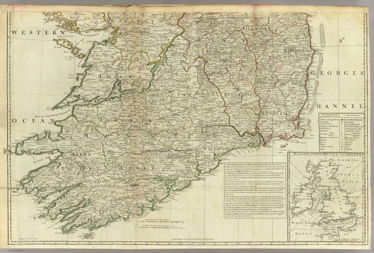
This map is a detailed look at the southern half of Ireland, replete with roads and barracks. The notations deferntate between cities, boroughs, and market towns. It’s an interesting look at how the Irish population spread was developing in 1790, immediately before a memorable century in history that hit Ireland hard.
Historic Maps of Ireland Circa 1800
The 1800s hit Ireland hard with the infamous Potato Famine mid-century, although it had also began rocky with a widespread uprising in 1798. The population growth impacting most of the world during the Industrial Revolution was having the opposite effect on Ireland, as a large amount of the Cathlic population immigrated elsewhere. Ireland went from having 32.5% of the United Kingdom’s population in 1821 with 6.8 million people, to only 11.2% by 1899 with 4.5 million people. (By comparison, England jumped from 14 million to 36 million in the same time frame.)
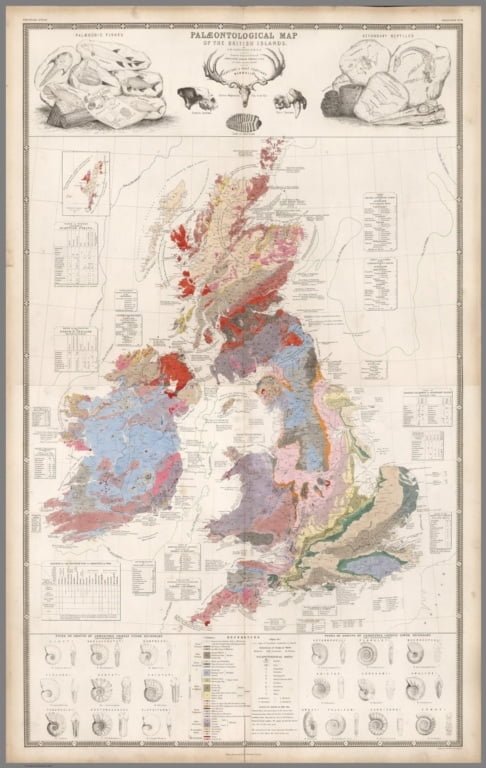
There are no notable maps tracing the population decline of Ireland through this century. Instead, this one focuses on paleontology–published by the Geographical Institute of Berlin in 1850.
This map is from Colton’s Atlas of the World, considered one of the most accurate atlases of the era. It was an American atlas published in New York in 1856, oddly appropriate considering the exodus of Irish to New York City during this time.
Current Maps of Ireland from 1900 – 2022
The Protestant vs. Catholic disagreement, a long-term friction in Irish history, finally reached breaking point in the early 20th century when Northern Ireland (Protestant British) and the Irish Free State (Catholic Irish) were formed to settle the matter–in a nicely boiled-down summation, anyway. The maps of this era strongly reflect the history of the period given the geopolitical nature of the conflict.
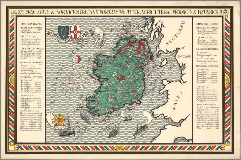
This map was published within the first decade of Ireland’s split, in 1929. It is from a Northern Ireland company, highlighting the agriculture and fisheries of both Irish countries. Notice how the dividing line runs quite similar to Ulster’s boundary line.
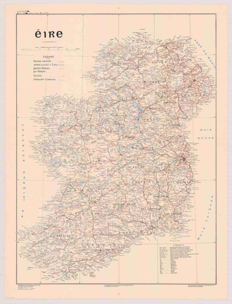
This one is interesting in a cultural light. We’ve seen Ireland, Hibernia, but this is the first we’ve seen of “Eire”–the original Gaelic name for Ireland. This map, from the American Geographical Society, disregards all recent conflict and instead records the original Gaelic/Irish names across Ireland.
Old Railway Map of Ireland
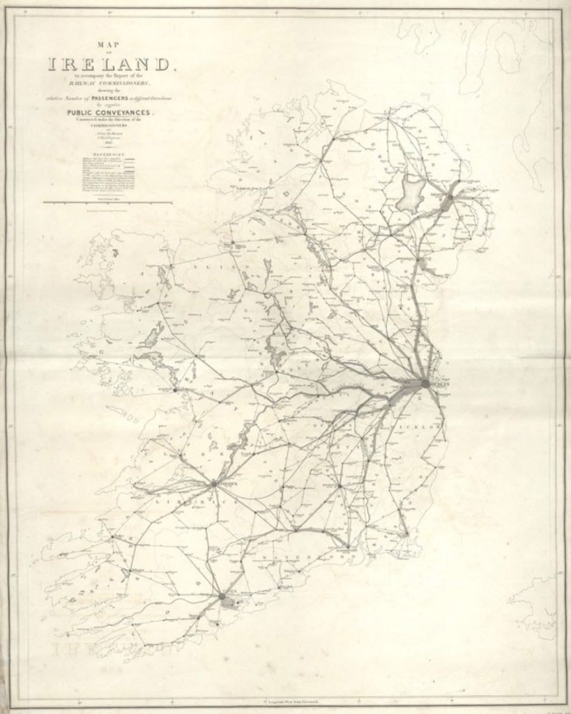
Despite the population loss that marked the Industrial Revolution for Ireland, there were also technological advances as well. Most notably for maps: railways. This is a map from the Second Report of the Railway Commission Ireland, made in 1891, detailing the active and proposed railway lines across Ireland.
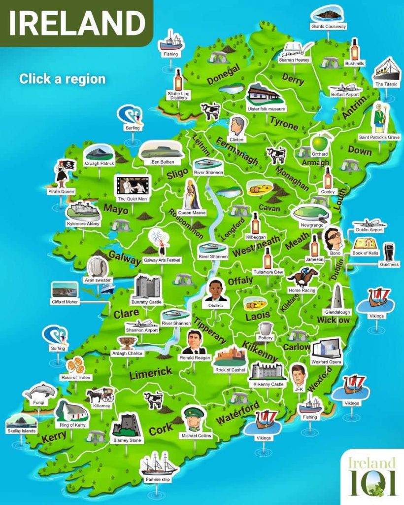
Tourist Map of Ireland
Ireland is full of amazing sites to visit, from Dublin Castle, right in the capital city, to natural wonders like the Giant’s Causeway and the Cliffs of Moher. But no trip to Ireland is complete without your chance to gain the “gift of the gab” by kissing the Blarney Stone at Blarney Castle.
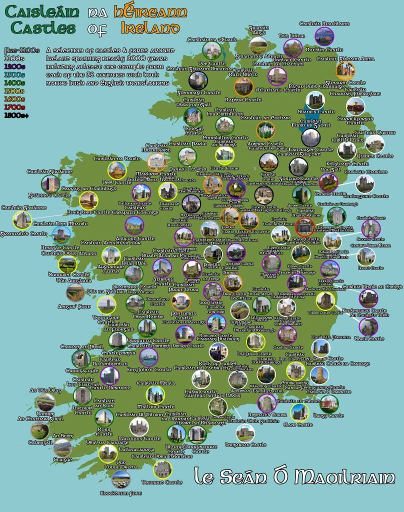
Ireland Castles Map
Of course, Ireland isn’t just known for its natural appeal–don’t miss the architectural highlights from Ashford Castle to Donegal to Kilkenny. The abbeys and other religious sites are awe-inspiring as well, from the famed Rock of Cashel to the lesser-known Kylemore Castle Abbey.
Five hundred years of maps should leave you well prepared to plan your own exploration of this beautiful country. It is well-worth the visit. We hope you’ve enjoyed this trip through time and look forward to hearing about your wonderful adventures in the Emerald Isle!